Weather
Winter Weather Advisory For North Jersey, Snow Expected Elsewhere
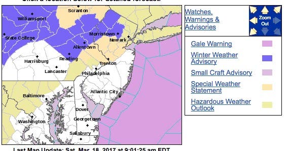
A winter weather advisory is in effect for North Jersey as more snow is expected to impact nearly the entire state.


More snow is heading toward New Jersey this weekend, and it will impact nearly the entire state.
The National Weather Service has issued a winter weather advisory for Morris, Sussex and Warren counties until 6 a.m. Sunday.
Hudson, Bergen, Union, Middlesex, Somerset, Hudson, Mercer and Passaic counties, which are expected to have "light" snow accumulations, have received a hazardous weather outlook. Nearly every county, however, is expected to receive some snow.
Find out what's happening in Hopatcong-Spartafor free with the latest updates from Patch.
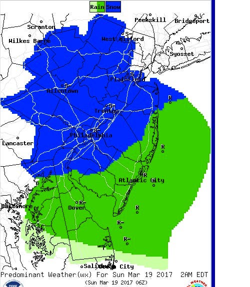
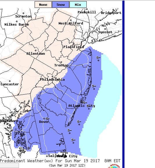
Here are the forecast maps for early Sunday:
Here is what is expected for those areas impacted by the winter weather advisory:
Find out what's happening in Hopatcong-Spartafor free with the latest updates from Patch.
- HAZARD TYPE...Snow.
- SNOW ACCUMULATIONS...3 to 6 inches in the elevated terrain, mainly above 1000 feet, and generally 1 to 3 inches in the valleys. There will be considerable melting on paved surfaces during the daylight hours.
- TIMING...Intermittent snow is expected to develop this morning. The snow is forecast to become steadier during the afternoon and it will mix with or change to rain in the valleys. The precipitation is expected to change back to all snow tonight. The most significant impact from this winter weather event should occur between 5 p.m. today and 5 a.m. Sunday.
- IMPACTS...Snow may create slippery conditions on area roads and walkways, especially this evening and tonight.
- WINDS...East around 5 to 10 mph today and northeast around 10 mph tonight.
- TEMPERATURES...Generally in the 30s today, falling into the middle 20s to lower 30s tonight.
Patch file photo
Get more local news delivered straight to your inbox. Sign up for free Patch newsletters and alerts.