Community Corner
Long Island Weather: Snow Forecast Goes Bust Again
We expect most readers won't be too upset.

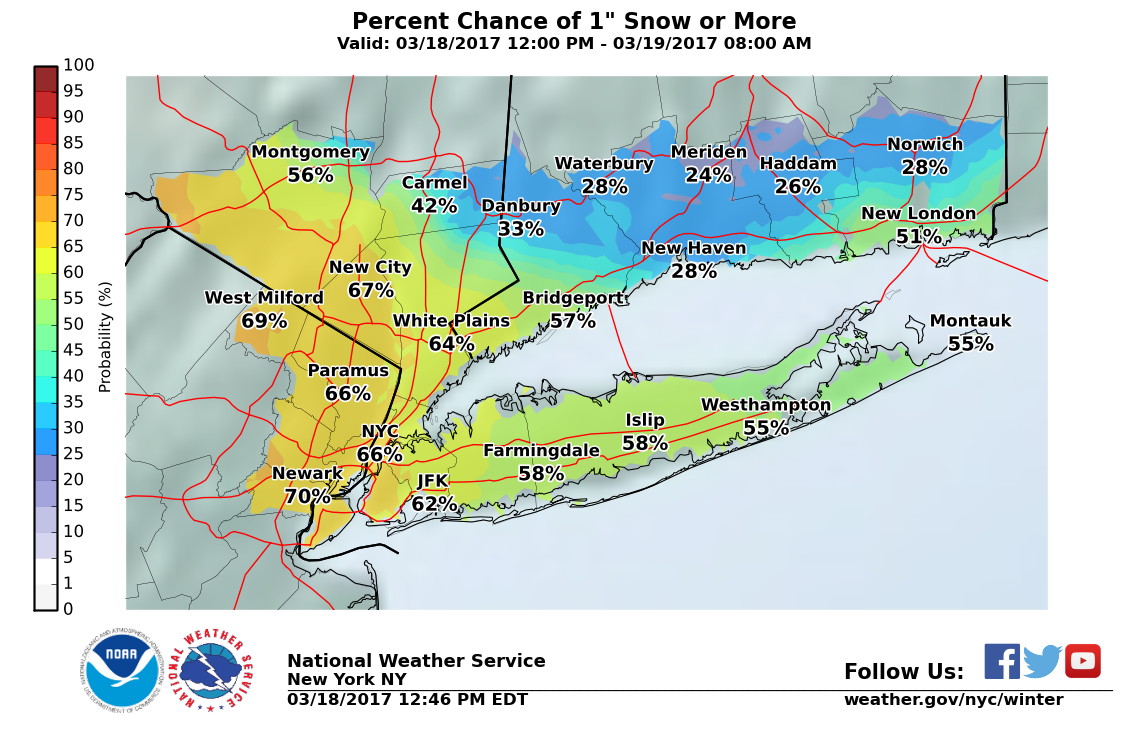
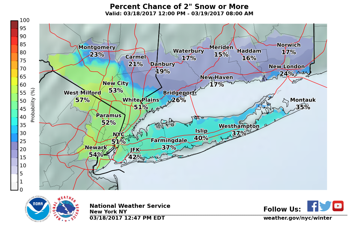
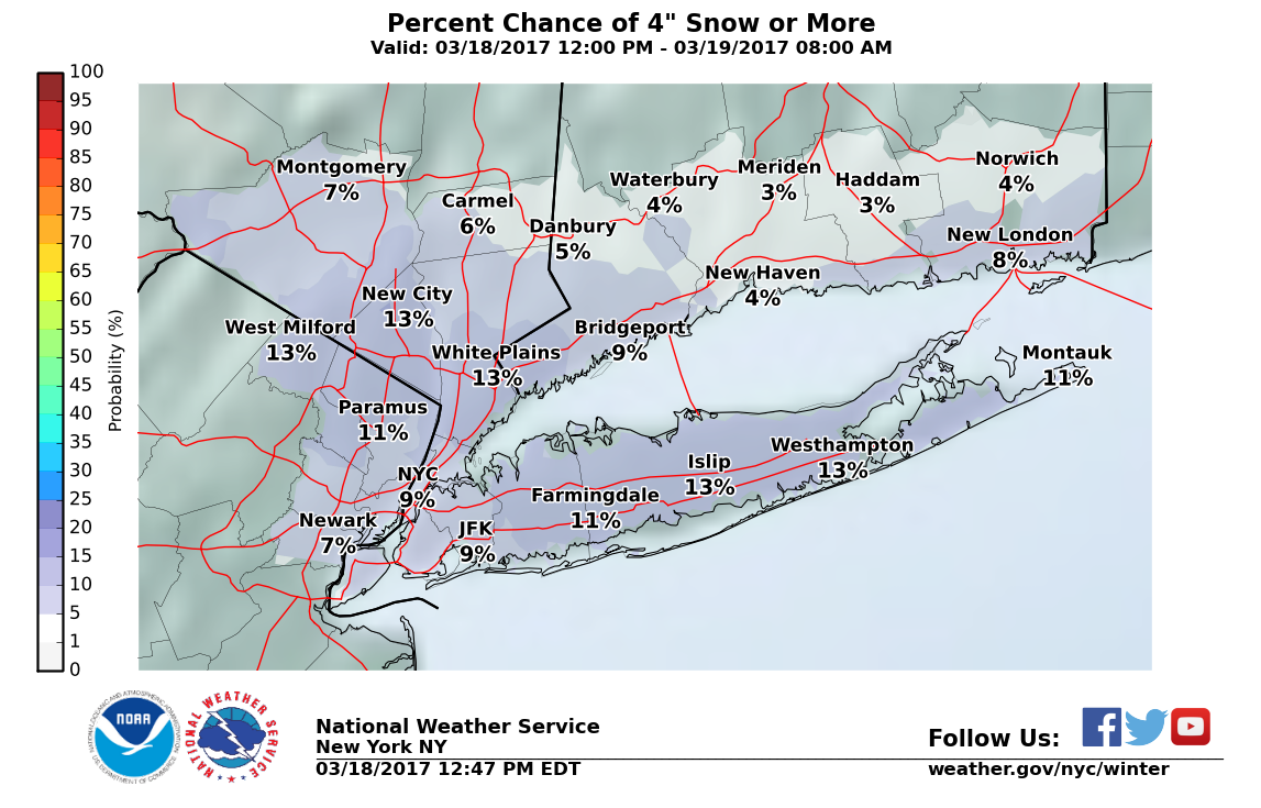
A hazardous weather outlook for Long Island has been canceled as any snow that falls Saturday night into Sunday morning will be light.
Less than an inch of snow is now expected to accumulate across the island. There is still the potential for up to 4 inches, but the odds are low–about 13 percent.
There are currently no other snow threats in the long-term forecast. The first day of spring is Monday.
Find out what's happening in East Hamptonfor free with the latest updates from Patch.
Find the full forecast and National Weather Service snowfall total maps below.
Saturday Afternoon- Light rain likely, mainly after 4pm. Cloudy, with a high near 42. East wind around 15 mph. Chance of precipitation is 60%.
Find out what's happening in East Hamptonfor free with the latest updates from Patch.
Saturday Night- Rain likely before 8pm, then rain and snow likely between 8pm and 10pm, then snow likely after 10pm. Cloudy, with a low around 31. Wind chill values between 20 and 25. Blustery, with an east wind 18 to 21 mph. Chance of precipitation is 60%. New snow accumulation of less than a half inch possible.
Sunday- A chance of snow before 10am, then a slight chance of rain between 10am and noon. Mostly cloudy, with a high near 42. Wind chill values between 20 and 30. Breezy, with a north wind 20 to 22 mph, with gusts as high as 36 mph. Chance of precipitation is 30%.
Sunday Night- Partly cloudy, with a low around 28. North wind 13 to 17 mph, with gusts as high as 29 mph.
Monday- Sunny, with a high near 45. Northwest wind 9 to 11 mph.
Monday Night- Mostly cloudy, with a low around 36.
Tuesday- Partly sunny, with a high near 48.
Get more local news delivered straight to your inbox. Sign up for free Patch newsletters and alerts.