Weather
When Will We Get A Break From Dangerous Cold Temperatures? It Could Set A Record
As the Hudson Valley digs out from a historic winter storm, Arctic cold grips the region making the cleanup particularly perilous.

HUDSON VALLEY, NY — It looks like the snow cover from the massive weekend storm will be hanging around for a while, along with dangerous cold temperatures in the Hudson Valley.
See: Hudson Valley's Big Snowfall Totals Released: How Much Snow Did You See In Your Town?
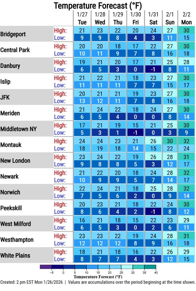
Much of the Hudson Valley will see single digit lows and subzero temperatures through the end of the work week, according to the National Weather Service forecasts. There is some chance of relief after the weekend, but not much. High temperatures on Monday will likely reach the low thirties.
Find out what's happening in New Rochellefor free with the latest updates from Patch.
And the possible brief climb from subfreezing temps will be followed by another chance of snow in the region over the weekend.
See Also: 6 Deaths In NYC May Be Linked To Extreme Cold, Snowstorm
Find out what's happening in New Rochellefor free with the latest updates from Patch.
"We've been below freezing since Friday night and may remain below freezing through next Monday, if not longer," according to the NWS. "That is over 9 days of below freezing temperatures! For context, the longest stretch of freezing temperatures at Central Park was 16 days in 1961."
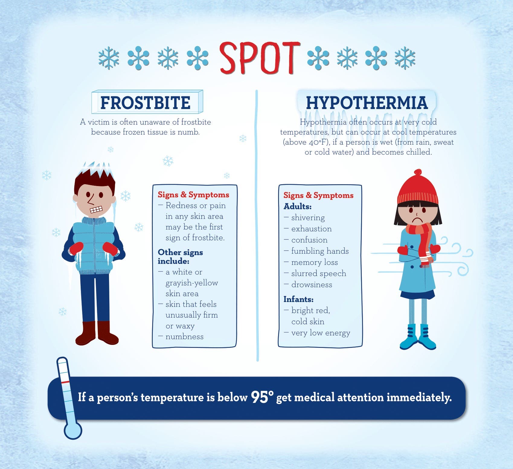
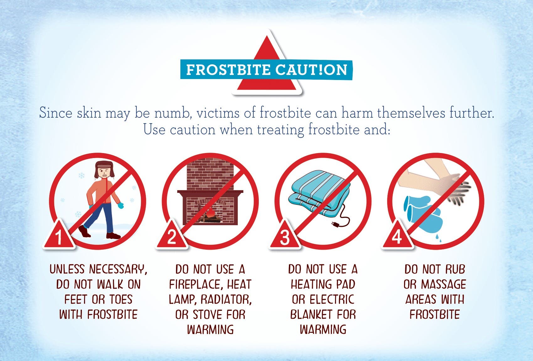
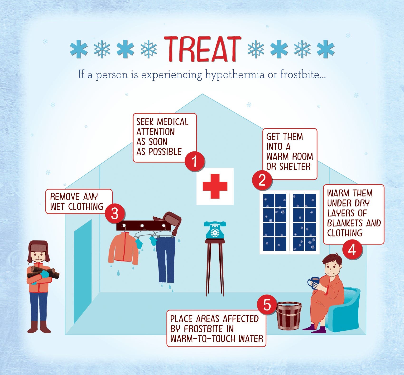
The National Weather Service said that the Arctic cold snap is more than just an annoyance. In cold temperatures, your body begins to lose heat faster than it can be produced, which can lead to serious health problems, the agency reminded.
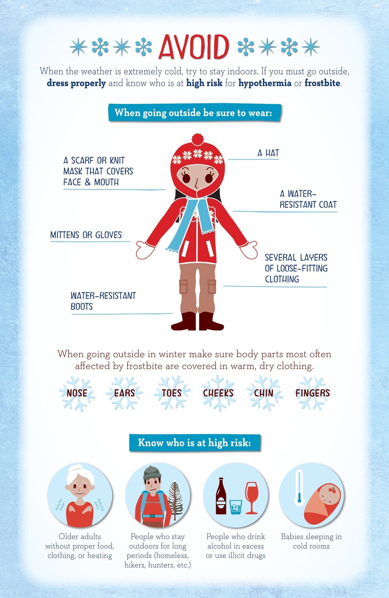
The NWS shared a few helpful tips on how to avoid, spot, and treat frostbite and hypothermia from the CDC.
Get more local news delivered straight to your inbox. Sign up for free Patch newsletters and alerts.