Weather
Hudson Valley Hazardous Outlook: Heavy Rain, Flash Floods Possible
Watch out for ponding on roads, forecasters said.


HUDSON VALLEY, NY — Heavy rain Monday morning, with scattered thunderstorms, could cause flash flooding, the National Weather Service predicted in a hazardous outlook issued at 3:48 a.m.
For Orange, Putnam, Rockland and Westchester counties: There is the potential for heavy rainfall associated with showers and isolated thunderstorms this morning, and isolated flash flooding will be possible across the area. However, the threat of flash flooding remains low for areas outside the metro area thanks to antecedent dry conditions. Within the metro area, the threat is also low due to uncertainty if and where 1"+/hr rainfall rates may develop.
For Dutchess and Ulster: Isolated non severe thunderstorms are expected today, mainly during the afternoon and evening. Some of these showers and storms may produce locally heavy rainfall.
Find out what's happening in Ossining-Croton-On-Hudsonfor free with the latest updates from Patch.
The Weather Prediction Center has placed the entire area in a marginal risk for excessive rainfall.
"Monday's downpours could lead to ponding on roadways as well as localized flash flooding, especially in low-lying areas," Courtney Travis, AccuWeather senior meteorologist.
Find out what's happening in Ossining-Croton-On-Hudsonfor free with the latest updates from Patch.
Whatever amount, the rain is more than welcome.
"It's not a drought buster... but it's a start," Bill Potter and Alex Marra of Hudson Valley Weather said on Facebook
The nation's drought monitors said in the most recent report on the mid-Hudson region:
The last 30 days have seen less than half of normal rainfall in corresponding approximately with the Moderate Drought (D1) depiction in the USDM. Below normal precipitation signals persist at the 60 and 90 day time frame, but the most significant dryness has been since the start of June. Temperatures have been well above normal for the last 30 days, as much as 5 degrees above normal. The below normal rainfall and above normal temperatures have contributed to a rapid deterioration of drought conditions over the last 30 to 45 days.
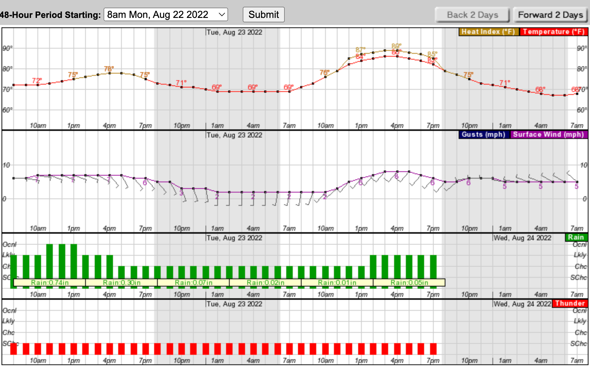
The NWS offers this look at the next 48 hours for southern Westchester:
Get more local news delivered straight to your inbox. Sign up for free Patch newsletters and alerts.