Politics & Government
Hastings-on-Hudson to Sign Waterfront Cleanup Consent Decree with Atlantic Richfield
The village and Riverkeeper have been negotiating with AR on the cleanup for years.

Hastings-on-Hudson, Atlantic Richfield and Riverkeeper are finalizing the remaining details of AR’s planned cleanup of 28 acres of contaminated waterfront property the company owns in the village, Mayor Peter Swiderski announced late Friday.
The land once held a wire manufacturing facility that leached contaminants into the soil and groundwater, and under the agreement, called a Consent Decree, the cleanup is scheduled to start in the spring of 2017.
“This document, once signed after approval by the Board of Trustees, will have very real positive impacts on the Village that will be apparent this year, as well as over the long-term future of our waterfront and Village,” Swiderski wrote in a letter to residents (the text from which is below).
Find out what's happening in Rivertownsfor free with the latest updates from Patch.
Fellow Residents,
I am pleased to announce that the Village is prepared to sign a renegotiated Consent Decree with Atlantic Richfield (“AR”), the unit of BP that is responsible for the remediation of the waterfront, and Riverkeeper that spells out some critical details regarding how the waterfront remediation is to occur. This document, once signed after approval by the Board of Trustees, will have very real positive impacts on the Village that will be apparent this year, as well as over the long-term future of our waterfront and Village.
Find out what's happening in Rivertownsfor free with the latest updates from Patch.
It will affect, among other things, how the shoreline will be treated, how high the waterfront will be raised (in part to avoid sea level rise), and what will happen to Building 52 (the remaining structure on the waterfront) and the iconic water tower. It will set aside monies for lawyers, engineers, and also the development of the future waterfront. It will also involve the restoration of Quarry Park, as well as setting aside money for the Historical Society so it can help preserve the history of the waterfront. It ties up the last details so that the design of the cleanup can proceed - and we would expect that this final design will be completed by March 2017, at which point the cleanup can begin in earnest.
This is a long email, but as important as any I have written to the community. It describes what the Consent Decree specifies and how that will affect you and the future of this Village. (Highlights are in bold.) If you want to read the Consent Decree itself, you can find it here.
Background===========
The Consent Decree is the result of several years of negotiations which involved AR, Riverkeeper, and the Village. It updates an earlier version first signed in 2003 to settle a lawsuit initiated by Riverkeeper, which the Village joined, to force AR to clean up the waterfront. Since then, NY State Department of Environmental Conservation (“NYSDEC”) has issued an updated set of directives, captured in a document called the Record of Decision. Requirements had changed enough so that the Consent Decree we had negotiated with BP needed to be updated. It was also an opportunity to re-examine suppositions in place at the time and make sure it reflected all our priorities.
What are some of the things that had changed? From our perspective, among other factors, Superstorm Sandy and the realization that climate change and rising sea levels would impact the waterfront had resulted in a shift in how we thought about the ground cover on the waterfront. Overall height became more important to us than the thickness of the cover. Also, we understood that the water tower was important enough to people in the community that options for its preservation should be included in an updated version of this document. We also believed that access to the waterfront was so crucial to the future that we wanted to make sure that any remedy incorporated explicit references to things like kayak put-ins and floating docks so that any engineering of the final design included these considerations.
BP Atlantic Richfield is the current owner of the portion of the waterfront covered by this agreement - the northern 28 acres of this 42 acre site. It is their property, their buildings, and the pollution beneath its soil and waters is their problem. But its ultimate disposition is our Village’s interest and hence why we joined the lawsuit and were active participants in all parts of this process. Our interests here are as follows:
- We want to see the waterfront clean enough to support all potential uses for future development.
- We want to see public access to the waterfront, via an esplanade and parks, as well as to the water, via boat launches, piers, or floating docks and to tie down as much open space as we can, now.
- We want to preserve history where we can, since the waterfront’s role was so core to Hasting’s origins.
- And, finally, we want this process to move forward as expeditiously as safety allows so that we can actually enjoy the fruits of this cleanup in our lifetime, and not let another generation slip away.
These are the broad areas covered by the decree.
Shoreline=========
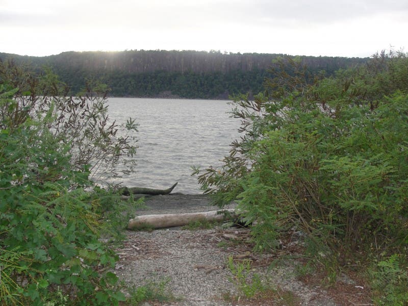
The Northwest Corner will extend approximately .7 acres into the Hudson, and involve removing some deeply contaminated soils and capping the site. The water’s edge will be finished with sheet piling forming a bulkhead to the Hudson. It will be engineered in a fashion to allow a walkway out to a floating dock. No heavy structures or pilings or pillars can be built in this area, though lightweight structures such as small cafes, kiosks or ticket booths will be allowed. The Northwest Corner will be dedicated open space that will be turned over to the Village.
While the Consent Decree allows the rest of the shoreline to be either bulkhead or a sloped shoreline to the water, we expect it to be largely a sloped shoreline covered with rocks (known as rip-rap) to armor it and prevent erosion (similar to what you see in Dobbs Ferry and Irvington), and then vegetated. A portion of the sloped shoreline will include a thirty-foot wide flat esplanade that will run the length of the waterfront and will be dedicated to the Village as open space for public use. We also include a provision for a concrete ramp or other similar boat launch suitable for launching non-motorized light watercraft like kayaks or canoes.
We will be working with consultants (funded by a grant we have received from NYSDEC) and AR to finalize the design on this shoreline over the next year. The process to design the shoreline will involve opportunities for substantial public input. We will release a schedule for this in the upcoming weeks.~
Site Elevation and Restrictions===========================
The previous Consent Decree specified a five-foot-thick cap on the site, laid down once the site was remediated to the point that it was safe for even residential use. We have replaced that with a performance guideline that the developable portion of the site be raised to 11 feet above low mean sea level (not above existing elevation). We have moved to this formulation with an eye to storm surges and sea level rise. (Those of you who were here during Super Storm Sandy understand why this became a priority to us.) Because there is concern that even 11 feet may not be enough, we have agreed that the remediation be designed to avoid creating any obstacles if a developer later wants to raise it to 14 feet above mean sea level .
Building height on the site cannot exceed 65 feet above the finished elevation of the site (although we can set a lower maximum height through zoning if desired) and all new buildings shall be constructed no closer than 100 feet from the shoreline (or 60 feet from the coves). This does not prevent facilities like boathouses or boat storage buildings, small cafes or public seating areas from being constructed within these 100 feet limits or within the Northwest Corner. Wells cannot be installed anywhere on the site, nor detached single-family structures built.
Dedicated Parkland=================
Between 6.25 acres and 14.25 acres of the 28-acre site will be set aside as dedicated open space:
- AR will designate the Northwest Corner (approximately 2 acres) as open space and dedicate it to the Village.
- A strip of land approximately 2.5 acres in size that will run along the shoreline (that flat 30-foot wide esplanade) which will also be designated as open space and dedicated to the Village.
- Another 1.75 acres of open space to be dedicated to the Village shall also be identified on a development proposal for the site formally submitted to the Village.
- Finally, AR may dedicate to the Village an additional 8 acres as open space, conditioned upon the agreement of AR and the Village on a development plan for the site.
Water Tower------------------
The iconic water tower sits atop a substantial pocket of pollution and has always been slated to be removed during part of the remediation effort. What was in question was the cooperation we could expect in saving that structure (if possible) and rebuilding it in the future, or creating a replica tower. To that end, we are pleased that AR has agreed to price out a full removal of the water tower and contribute those monies to the Village if we determine that the structure is sound enough to be saved and can be brought down in an orderly fashion to be rebuilt in the future. This would need to be done in a reasonably expeditious way that would not interfere with the remediation of the waterfront.
Additionally, we are very pleased to report that AR is also dedicating up to $1,350,000 in matching funds to help either restore or create a new water tower on the site, to be paid out starting when a contract to restore or replace the water tower has been signed. Ultimately, the fate of the water tower belongs in the hands of Village residents. To that end, the Village will soon determine whether the tower is structurally sound enough to take down and preserve for eventual restoration. We will be doing this shortly. Then, we will seek public input on the fate of the water tower via a village vote that will ask if the public wants the water tower restored (if that is an option), replaced, or not replaced and also if that should be something the Village should pay for. This process would unfold over the first half of this year so we could have a determination in time so that it does not interfere with the remediation efforts expected to start next year.
Building 52----------------
Building 52 carries the weight of history for the waterfront. It is both a resonant structure that speaks to the industrial past of the waterfront, as well as the literal birthplace of PCBs and source of the PCB pollution that stains the northern portion of the site. We would like to have seen a way to negotiate the salvage of the structure, but given the degree of pollution and our desire to see the site as fully remediated as can be managed without years of further delay, we are not opposed to Arco’s position that the demolition of Building 52 will effectuate remediation of the soils contaminated with PCBs and other hazardous substances underneath, within and in the immediate vicinity of the building.
To that end, the Consent Decree was submitted along with an application for a permit to demolish the building. If the Board of Trustees approves the demolition permit, we would expect to see the structure brought down by the middle of this year. The Consent Decree will need to be renegotiated if the demolition permit is not granted.
Trust Fund, Quarry Park and Historical Society funding
------------------------------------------------------------------------
The Trust Fund originally set up under the first Consent Decree remains in effect, seeded with $1,400,000. Those monies can be used for river-related projects that the three parties agree on, and the Village views this as funding for the creation of parks and the esplanade once the remediation is complete.
Additionally, we are very pleased to announce that AR will fund the Village Trust Fund with an additional $1.3 million dollars to clean up and restore Quarry Park and finish restoring the trail that links Quarry Park with the waterfront. Quarry Park, found between Draper Park and the Aqueduct, has been shut for decades since it was used as a Village dump. These monies would be sufficient to clean up and return the site to public use. This would renovate the last acreage of parkland left east of the railroad tracks in Hastings, creating a continuous chain of parks and trails from the waterfront to Broadway, and then via the Burke Estate to Farragut Avenue. It provides additional parkland to the Washington Avenue and Warburton Avenue neighborhood and undoes a historical mistake where this beautiful property was so terribly wasted as a dump.
Finally, once the remediation is complete, AR will fund the Village Trust Fund with $50,000 for use by the Historical Society to preserve and present historical documents, photos and other materials related to the history of the site.
Remediation Funds
--------------------------
AR will cover the engineering costs that Hastings incurs to verify the remediation is being done correctly, up to $300,000. NYSDEC will also be carefully monitoring the remediation process. Any monies that remain in that fund will be transferred into the Trust Fund described above. AR has also agreed to pay $40,000 of the legal costs the Village has incurred in negotiating this version of the Consent Decree, covering the substantial majority of the expense incurred.
Other clauses
-------------------
The Consent decree includes other provisions worth noting and of significant importance to the Village:
- It asks AR to use all reasonable efforts to maximize the use of barges and rail to transport materials excavated from the site and to bring equipment and material to the site rather than running what could be thousands of truckloads through the Village.
- Trenches for new utilities will be over-excavated to remove contaminants so it can be maintained in the future without requiring future excavation of soils.
- AR will be responsible for maintaining the bulkheads, sloped shoreline, and cap for 100 years. The village will be responsible for planting and maintaining the open spaces dedicated to public use.
I believe that we have come to terms here that satisfy our priorities. These were negotiations. All parties came away with something they wanted, and all parties left something on the table. I know that there will be items here that satisfy some members of the public, and others that won’t. That is the nature of a negotiated settlement.
At every critical juncture during the negotiations of this Consent Decree, the Board was kept informed as to the decisions being made and provided input and support. Trustee Walker, especially, focused on waterfront uses, but all Trustees participated in reviewing the progress of these negotiations. The Trustees are prepared to sign this consent decree. On February 3rd, we will have a meeting for the public where residents can prove public comment on the Demolition Permit that has been submitted, and provide public input on the Consent Decree.You should also feel free to submit any comments on either the permit or the Decree toboard@hastingsgov.org.On February 16th, we will vote on the decree in its current form and the Demolition Permit. Public comment and input can still sway Board opinion – and if either the Permit or the Decree fails to garner three votes, they will require a renegotiation.
I believe, however, that the Decree yields, as I have described, many benefits to the community while moving this critical project forwarded. I think it deserves your support, and I believe it will enjoy that support from most residents.
This is an exciting and important step forward that preserves the Village’s and Riverkeeper’s interests while shaping the future of the waterfront that will ensure it is robust, sustainable and resilient. The Board looks forward to these vital steps on the way to a remediated waterfront finally returned to productive use for us all.
Sincerely,
Peter Swiderski
Mayor
mayor@hastingsgov.org
Get more local news delivered straight to your inbox. Sign up for free Patch newsletters and alerts.