Weather
Hazardous Weather Outlook Issued For Strong Overnight Storms
A storm with potentially damaging effects is expected to hit the region.


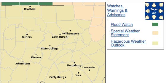
A thunderstorm with potentially damaging effects is expected to hit Pennsylvania on Monday night and Tuesday morning. The National Weather Service has issued a hazardous weather outlook for the entire state, saying severe thunderstorms are possible Tuesday evening and into the overnight hours. Damaging winds are expected to be the primary hazard.
Here are the alerts for Pennsylvania:
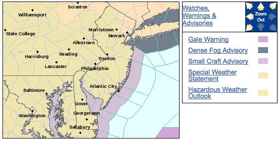

The storms will be an extension of damaging thunderstorms and torrential downpours that will threaten the northeastern United States into Monday evening, according to AccuWeather.
Find out what's happening in Newtownfor free with the latest updates from Patch.
A press of cooler air will clash with building warmth and humidity over the mid-Atlantic and interior Northeast to start the month of May, according to an AccuWeather release. Residual showers and thunderstorms from the morning hours will intensify as they move east.
Severe thunderstorms are possible this evening across the region. Damaging winds are the primary threat. #pawx #njwx #dewx #mdwx pic.twitter.com/x0dqbzx4fh
— NWS Mount Holly (@NWS_MountHolly) May 1, 2017
Here is the forecast:
Find out what's happening in Newtownfor free with the latest updates from Patch.
- Monday: Areas of fog before noon. Otherwise, partly sunny, with a high near 81. Breezy, with a southwest wind 11 to 20 mph, with gusts as high as 32 mph.
- Monday night: Showers and thunderstorms likely between 10pm and 3am, then a chance of showers. Some of the storms could produce gusty winds. Mostly cloudy, with a low around 64. Breezy, with a south wind 16 to 20 mph, with gusts as high as 30 mph. Chance of precipitation is 70 percent. New rainfall amounts between a tenth and quarter of an inch, except higher amounts possible in thunderstorms.
- Tuesday: Mostly sunny, with a high near 73. Breezy, with a west wind 11 to 21 mph.
- Tuesday night: Mostly cloudy, with a low around 48. West wind 8 to 13 mph.
Patch file photo
Get more local news delivered straight to your inbox. Sign up for free Patch newsletters and alerts.