Weather
PA Weather: Freezing Cold Moves In, More Snow Possible
As we head toward New Year's Day, there are some big weather changes coming and a chance for more snow. Here's the latest details. ...

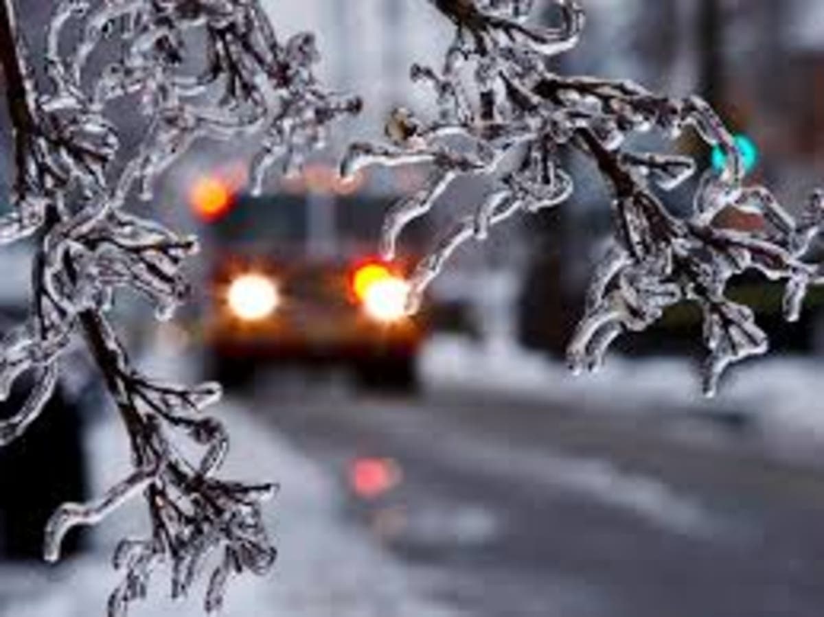
Some of the worst weather of the year is expected to hit Pennsylvania this week, but it won't be just rain or snow that will cause problems for millions of the state's residents.
Temperatures are supposed to drop to horribly low levels - particularly in the overnight hours, when it could plunge to as low as 8 to 12 degrees. New Year's Eve is supposed to be as cold as 12 degrees.
On top of that, there are several chances of snow and freezing rain as Pennsylvanians could get a slippery New Year's Eve weekend. Snow could fall on Friday, Friday night and Saturday.
Find out what's happening in Newtownfor free with the latest updates from Patch.
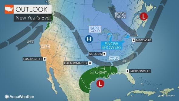
The arctic cold wave gripping the central and eastern United States for the final week of 2017 is not expected to release its grip by the time tens of thousands are celebrating New Year’s Eve, according to AccuWeather.
"For those looking ahead to the New Year's holiday, the cold pattern that developed this week in the central and eastern part of the country is expected to persist for the remainder of 2017," AccuWeather Long-Range Meteorologist Max Vido said in a release.
Find out what's happening in Newtownfor free with the latest updates from Patch.
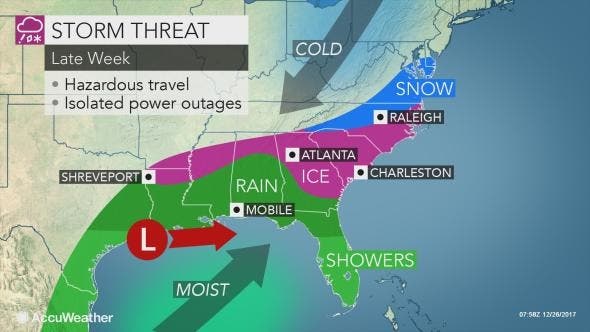
The interaction between a storm in the South and a storm that will move across the Midwest will determine how the Northeast will be impacted Friday into Saturday, according to AccuWeather.
"The potential for a more substantial snowfall will be possible across the mid-Atlantic and Northeast if the northern storm links up with the southern storm," Vido said.
Lesser impacts are possible should the two storms fail to interact and the southern storm tracks eastward out to sea. However, a stronger interaction of the two could form a nor'easter along or just off the Atlantic coast.
"Timing will be essential to whether or not this region has a significant winter storm," Vido said.
Here is the forecast:
- Tuesday: Mostly sunny, with a high near 20-30. West wind 8 to 15 mph.
- Tuesday night: Mostly cloudy, with a low around 13. Northwest wind 5 to 9 mph.
- Wednesday: Mostly sunny, with a high near 17-26. Northwest wind 6 to 13 mph.
- Wednesday night:Mostly clear, with a low around 7-10. Wind chill values as low as -1. Northwest wind 6 to 8 mph.
- Thursday: Mostly sunny, with a high near 22. Northwest wind 8 to 11 mph.
- Thursday night: Mostly cloudy, with a low around 7-13.
- Friday: A chance of snow after noon. Partly sunny, with a high near 15-25. Chance of precipitation is 30%.
- Friday night: A chance of snow. Mostly cloudy, with a low around 15. Chance of precipitation is 30%.
- Saturday: A chance of snow. Partly sunny, with a high near 27. Chance of precipitation is 30%.
- Saturday night: Mostly cloudy, with a low around 14.
- Sunday: Mostly sunny, with a high near 24.
- Sunday night: Mostly cloudy, with a low around 12.
- New Year's Day: Partly sunny, with a high near 24.
Patch photo
Get more local news delivered straight to your inbox. Sign up for free Patch newsletters and alerts.