Weather
Storm Alberto Could Ruin The 1st Weekend Of June: PA Weather
The storm system will create unsettled weather with rain through the weekend, forecasters say.

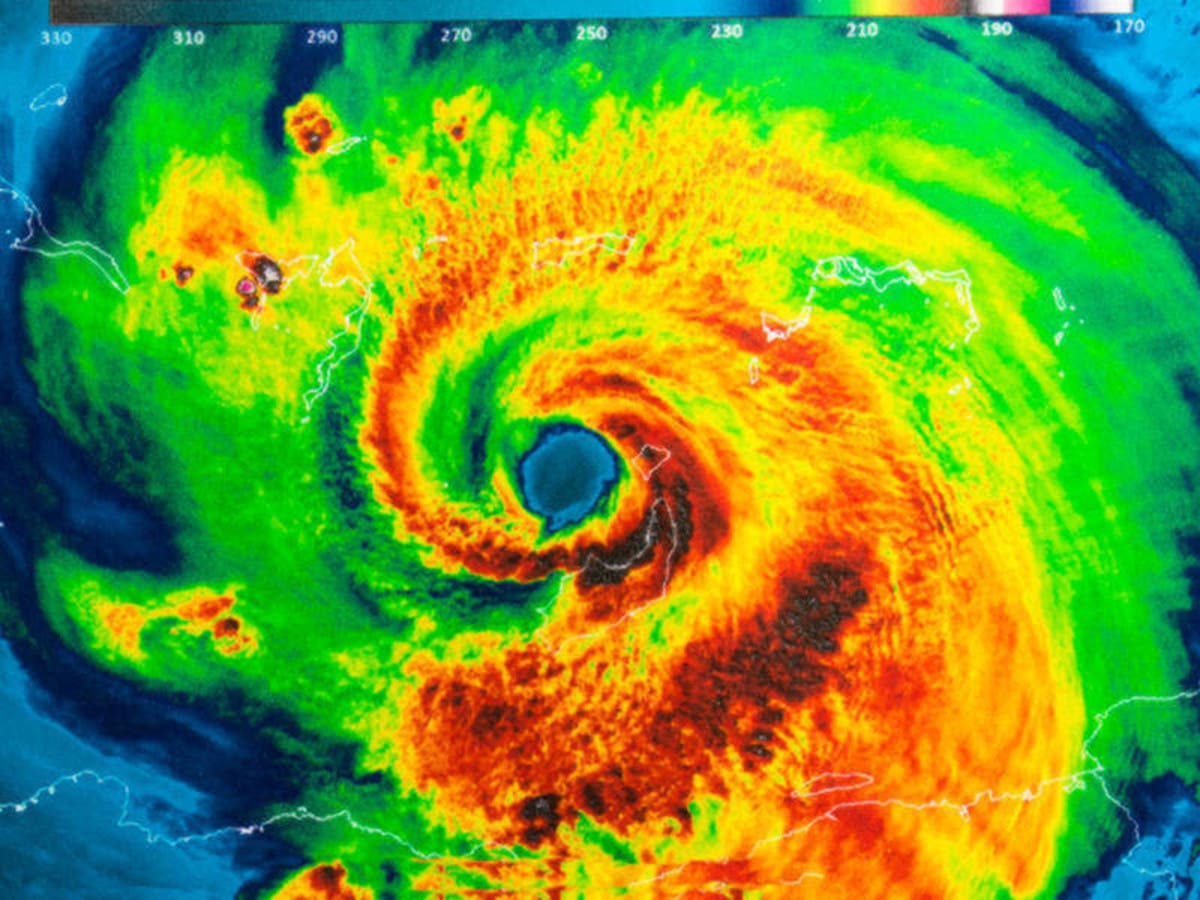
Though Subtropical Storm Alberto has already crashed ashore on Florida's Gulf Coast and is expected to churn through the United States on a path far west of Pennsylvania, its impacts will still be felt in the area, forecasters predict.
The storm system will create unsettled weather with rain possible through the weekend, forecasters say. The Philadelphia area could see some rain on five straight days from Thursday to Monday.
The storm, the first of the 2018 season, hit the Florida Panhandle Monday and is dumping up to 8 inches of rain on Alabama and other southern states. It is expected to drench areas as far north as Chicago. After that, it will track through Michigan and into Canada, according to the National Weather Service.
Find out what's happening in Newtownfor free with the latest updates from Patch.
"Although the track of Alberto will take it into the upper Great Lakes by later this evening, unsettled conditions should generally be expected across the entire eastern third of the nation," forecasters with the NWS said Thursday morning. The heavy rain may lead to flash flooding, landslides, and falling trees over the next several days, the NWS said.
AccuWeather reports the surge of tropical air will cause downpours and a risk of flash flooding in the Northeast late this week and into the weekend. This follows a wet Memorial Day weekend which saw flash flooding on Sunday in parts of the Philadelphia region and beyond.
Find out what's happening in Newtownfor free with the latest updates from Patch.
Here is the local forecast:
Today: A slight chance of showers after 2pm. Patchy fog before 10am. Otherwise, partly sunny, with a high near 75. East wind around 9 mph. Chance of precipitation is 20%.
Tonight: Showers likely, mainly after 1am. Mostly cloudy, with a low around 62. East wind around 9 mph. Chance of precipitation is 70%. New precipitation amounts of less than a tenth of an inch possible.
Thursday: Scattered showers and thunderstorms, then showers likely and possibly a thunderstorm after 2pm. Cloudy, with a high near 75. East wind around 6 mph. Chance of precipitation is 60%. New rainfall amounts of less than a tenth of an inch, except higher amounts possible in thunderstorms.
Thursday Night: Showers likely and possibly a thunderstorm before 2am, then scattered showers and thunderstorms after 2am. Cloudy, with a low around 68. Southeast wind 3 to 6 mph. Chance of precipitation is 60%. New rainfall amounts between a tenth and quarter of an inch, except higher amounts possible in thunderstorms.
Friday: Scattered showers before 8am, then scattered showers and thunderstorms after 2pm. Mostly cloudy, with a high near 88. Calm wind becoming southwest around 6 mph in the afternoon. Chance of precipitation is 40%. New rainfall amounts between a tenth and quarter of an inch, except higher amounts possible in thunderstorms.
Friday Night: Scattered showers and thunderstorms. Mostly cloudy, with a low around 69. Chance of precipitation is 50%. New precipitation amounts of less than a tenth of an inch, except higher amounts possible in thunderstorms.
Saturday: Scattered showers. Mostly cloudy, with a high near 78. Chance of precipitation is 50%.
Saturday Night: Scattered showers. Mostly cloudy, with a low around 60. Chance of precipitation is 50%.
Sunday: A chance of showers. Mostly cloudy, with a high near 69. Chance of precipitation is 40%.
Sunday Night: A chance of showers. Mostly cloudy, with a low around 55. Chance of precipitation is 30%.
Monday: A chance of showers. Mostly cloudy, with a high near 69. Chance of precipitation is 30%.
Monday Night: Mostly cloudy, with a low around 56.
Tuesday: Partly sunny, with a high near 74.
Take a look at THIS pic of Pensacola as #Alberto approaches the Florida Coast! Lynn Rodriguez @StormHour @spann @NWSMobile pic.twitter.com/NZPsXoc7f7
— Jake Dunne, MS (@Jake_WPMI) May 29, 2018
With reporting by Adam Nichols
Get more local news delivered straight to your inbox. Sign up for free Patch newsletters and alerts.


