Weather
Timeline Of Severe Weather Wednesday Across Eastern PA
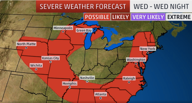
Here is the timeline for today's expected severe weather:

EASTERN PENNSYLVANIA — If you have something planned outdoors this evening, you'll want to keep an eye on the weather. Severe storms are headed to Eastern Pennsylvania, and could bring flash flooding, according to the National Weather Service.
The storms are expected to arrive Wednesday afternoon, and continue through the evening. "Periods of heavy rain can be expected with areas of 1 to 2 inches, with local amounts of 3 to 4 inches possible. Heavy rainfall falling in a short amount of time could lead to flash flooding," the NWS said.
A Flash Flood Watch is in place from 2 to 10 p.m. Wednesday.
Find out what's happening in Newtownfor free with the latest updates from Patch.
The severe weather could bring damaging winds and even hail, according to The Weather Channel. Commuting delays are likely in the Northeast and mid-Atlantic Wednesday afternoon and evening, The Weather Channel warns.
According to the forecast, the storms are predicted to start in Eastern Pennsylvania around 3 p.m. The storms could continue throughout the evening and night. A stray isolated thunderstorm could linger past midnight, The Weather Channel predicts.
Find out what's happening in Newtownfor free with the latest updates from Patch.
The highest likelihood of strong storms is between 5 and 8 p.m., according to The Weather Channel.
There is some good weather-related news, however.
Once this batch of severe weather passes, it looks like we are in for a stretch of pleasant conditions. There is a slight chance of more storms on Thursday, but after that sunshine dominates the forecast for the next several days.
Here is the local forecast:
Today: Showers and thunderstorms, mainly after 3pm. Some of the storms could produce gusty winds and heavy rain. High near 87. Southwest wind 5 to 10 mph. Chance of precipitation is 80%. New rainfall amounts between a tenth and quarter of an inch, except higher amounts possible in thunderstorms.
Tonight: Showers and thunderstorms, mainly before midnight. Some of the storms could produce gusty winds and heavy rain. Low around 69. Southwest wind 5 to 8 mph becoming calm after midnight. Chance of precipitation is 80%. New rainfall amounts between a half and three quarters of an inch possible.
Thursday: A chance of showers and thunderstorms, mainly between 9am and 10am. Partly sunny, with a high near 88. West wind 3 to 6 mph. Chance of precipitation is 30%.
Thursday Night: A slight chance of showers and thunderstorms before 9pm. Partly cloudy, with a low around 69. West wind around 6 mph. Chance of precipitation is 20%.
Friday: Sunny, with a high near 85. Northwest wind 5 to 9 mph.
Friday Night: Mostly clear, with a low around 63.
Saturday: Sunny, with a high near 83.
Saturday Night: Mostly clear, with a low around 62.
Sunday: Sunny, with a high near 85.
Sunday Night: Mostly clear, with a low around 64.
Monday: Mostly sunny, with a high near 87.
Monday Night: Partly cloudy, with a low around 66.
Tuesday: Mostly sunny, with a high near 86.
Get more local news delivered straight to your inbox. Sign up for free Patch newsletters and alerts.