Community Corner
WEATHER ALERT: Police Warn Drivers to Stay Off Roads, Speed Restrictions in Place
As much as six inches of snow is predicted to fall Saturday in Eastern Pennsylvania. Precipitation is expected to change to rain overnight.

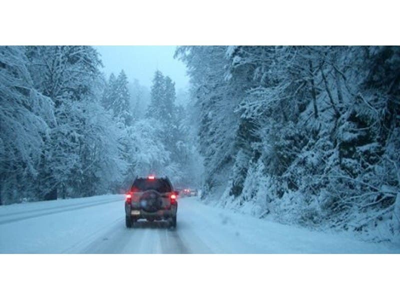
PennDOT has reduced speed limits on major highways and local police are asking drivers to stay off the roadways as another round of weekend snow passes through the Philadelphia region.
The snow began around noon throughout the region. We could see up to 6 inches of snow before warmer air moves in and the precipitation changes to a wintry mix of snow, sleet and rain overnight. A Winter Storm Watch is in effect through 6 a.m. Sunday.
PennDOT said it urges motorists to avoid travel but those who must head out will see speeds reduced to 45 mph on the following roadways:
Find out what's happening in Newtownfor free with the latest updates from Patch.
- Interstates 76, 95, 476, 676
- U.S. Routes 1, 30, 202, 422, and
- State Routes 63, 100 Spur and 309
Several local police departments have asked residents to stay off the roads, if possible. In Upper Makefield Township, Bucks County, the police department announced via Facebook that road conditions were “not good.”
And in nearby Solebury Township, police announced roadways were snow covered and asked drivers to stay home “as conditions will worsen throughout the day.”
Find out what's happening in Newtownfor free with the latest updates from Patch.
Warmer air is expected to move through the region Saturday night, causing the precipitation to turn to rain. Expect another blast of frigid air soon though, as an Arctic front will move into the region Sunday night, bringing below-normal temperatures early next week.
Here’s the hour-by-hour forecast:
- Saturday: Snow. High near 29. Chance of precipitation is 90 percent. New snow accumulation of 2 to 4 inches possible.
- Saturday night: Snow and sleet before 11 p.m., then rain, possibly mixed with snow. The rain and snow could be heavy at times. Temperature rising to around 36 by 1 a.m. South wind 7 to 9 mph. Chance of precipitation is 100 percent. New snow and sleet accumulation of 2 to 4 inches possible.
- Sunday: A chance of rain and snow before 7 a.m., then a chance of rain between 7 a.m. and 1 p.m. Cloudy, then gradually becoming mostly sunny, with a high near 37. Northwest wind around 8 mph. Chance of precipitation is 30 percent. Little or no snow accumulation expected.
- Sunday night: Partly cloudy, with a low around 15. Northwest wind 9 to 13 mph.
RELATED:
Get more local news delivered straight to your inbox. Sign up for free Patch newsletters and alerts.