Community Corner
National Weather Service Issues Tornado Watch
Watch is for entire metro DC area. What time could storms hit?

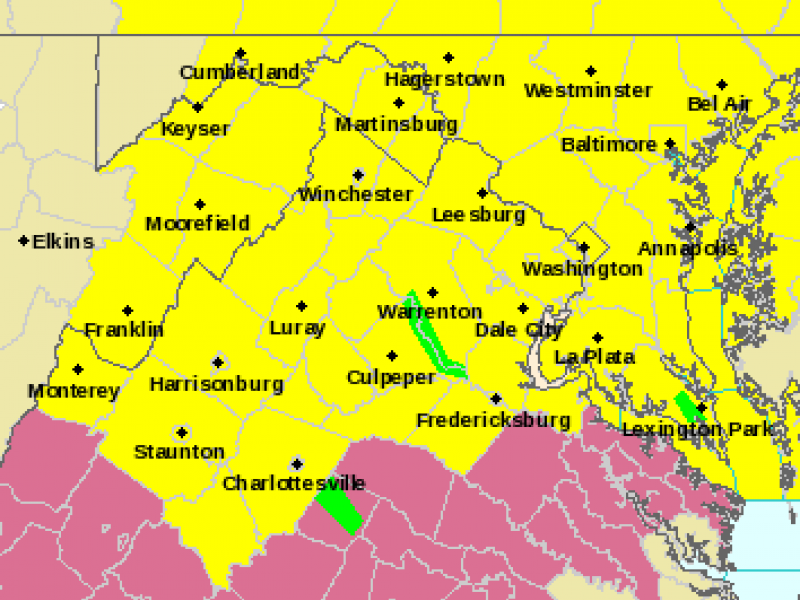
MAP: Area in yellow is under a Tornado Watch Monday until 10 p.m. Map courtesy of National Weather Service.
The National Weather Service Monday afternoon has issued a Tornado Watch for the entire metro DC area. The watch alert was issued at 3:05 p.m. ET.
The Tornado Watch is in effect until 10 p.m. Monday. A Tornado Watch means that conditions are favorable for the development of a tornado. A more severe alert, a Tornado Warning, is issued when tornadoes may be imminent.
Find out what's happening in Fairfax Cityfor free with the latest updates from Patch.
Before the storm system swoops through, temperatures are expected to hit up to 80 degrees Monday, according to the National Weather Service.
The timing of storms that may hit the area:
Find out what's happening in Fairfax Cityfor free with the latest updates from Patch.
“ Damaging winds, heavy rain and even hail will be the main threat for any of these storms,” says NBC-4 meteorologist Tom Kierein. “We expect it to enter our western suburbs around 3 ish (I-81 area) and continue to move eastward through the late afternoon and into the evening. Most of the storms should be out of here by 10 p.m.”
A flood watch was previously in effect for the Northern Virginia area Sunday night into Monday.
Get more local news delivered straight to your inbox. Sign up for free Patch newsletters and alerts.