Weather
Another Round Of Storms On The Way To Eastern PA
Another round of storms is on the way, just days after severe flooding closed roads, damaged homes, and prompted rescues across the region.

Just days after severe flooding closed roads, damaged homes and businesses, and prompted numerous water rescues, we're in for another round of storms, according to forecasters. Thunderstorms are expected to blanket the region Friday. AccuWeather predicts some of the storms could be "robust."
The additional rainfall comes as the ground is already soggy following numerous round of heavy rain throughout the month.
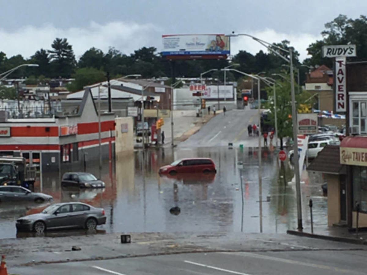
The Philadelphia region is still recovering after strong rains caused serious flooding on Monday. The flooding closed highways, including part of the Pennsylvania Turnpike. It also stranded shoppers in the King of Prussia mall, and did unbelievable damage in Delaware County.
Find out what's happening in Newtownfor free with the latest updates from Patch.
The Delaware River is running nine feet over normal levels as of Thursday. Recreational activities on the river are not advised, authorities have said.
Not only does this next storm present a flooding risk, but there are also safety concerns due to falling trees and limbs, AccuWeather said.
Find out what's happening in Newtownfor free with the latest updates from Patch.
"Trees have been drawing a great deal of moisture up their trunk and limb systems due to above-normal rainfall that has been pummeling the area during July and August. Many trees may be top-heavy as a result.Even an isolated, non-severe thunderstorm has the potential to bring down large tree limbs and even topple trees in this situation," AccuWeather said in a Thursday news release.
The storms will also bring winds, with gusts of up to 30 50 mph in some areas, AccuWeather said.
"The anticipated gusts are strong enough to topple weakly rooted trees and break diseased or stressed tree limbs. As the storms approach, people should avoid standing, camping or parking beneath large trees due to the risk."
Here is the forecast:
This Afternoon: Mostly sunny, with a high near 92. West wind around 7 mph.
Tonight: Partly cloudy, with a low around 73. West wind around 5 mph becoming calm in the evening.
Friday: Showers and thunderstorms likely, mainly after 2pm. Some of the storms could produce heavy rainfall. Mostly cloudy, with a high near 92. Heat index values as high as 100. Light southwest wind increasing to 6 to 11 mph in the morning. Winds could gust as high as 21 mph. Chance of precipitation is 70%. New rainfall amounts between a tenth and quarter of an inch, except higher amounts possible in thunderstorms.
Friday Night: Showers and thunderstorms likely, mainly before 2am. Some of the storms could produce heavy rainfall. Mostly cloudy, with a low around 72. Southwest wind 6 to 8 mph. Chance of precipitation is 60%. New rainfall amounts between a quarter and half of an inch possible.
Saturday: A chance of showers and thunderstorms. Mostly cloudy, with a high near 88. West wind 6 to 8 mph. Chance of precipitation is 50%. New rainfall amounts of less than a tenth of an inch, except higher amounts possible in thunderstorms.
Saturday Night: A slight chance of showers and thunderstorms. Mostly cloudy, with a low around 67. Chance of precipitation is 20%.
Sunday: Mostly cloudy, with a high near 82.
Sunday Night: Partly cloudy, with a low around 63.
Image of Monday flooding via Upper Darby Police
Get more local news delivered straight to your inbox. Sign up for free Patch newsletters and alerts.


