Crime & Safety
Upper Makefield Braces For Another Round Of Flooding
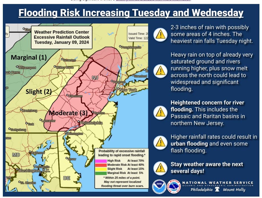
The National Weather Service has issued a flood watch for Tuesday and Wednesday for up to three inches of additional rainfall.

UPPER MAKEFIELD, PA — As one storm departs, another one will be moving in.
Forecasters are predicting two to three inches of additional rain from a storm moving in for Tuesday and Wednesday. If the forecast holds true, the area will see flooding, especially with the ground still saturated from the last few storms, police said.
The National Weather Service has issued a flood watch for the entire region from Tuesday afternoon to Wednesday afternoon.
Find out what's happening in Newtownfor free with the latest updates from Patch.
Forecasters are saying that excessive runoff may result in flooding of rivers, creeks, streams, and other low-lying and flood-prone locations. Area creeks and streams are running high and are expected to flood with more heavy rain.
In Upper Makefield, police said they are expecting flooding to occur in the usual areas:
Find out what's happening in Newtownfor free with the latest updates from Patch.
- Eagle Road north of Stoneybrook.
- Stoneybrook Road at the bridge between Shannon Road and Slack Road.
- River Road between Jonathan Way and Francisco’s on the River
- Brownsburg Road East north of Stoneybrook Road.
The township's emergency management officials will also be monitoring additional locations in the township for potential impacts from the storm.
With saturated ground and high winds, a few trees may also come down. Residents may want to check their generators in advance of the storm, purchase fresh batteries for their flashlights, and to fill a bathtub with water.
Police encourage residents to monitor social media throughout the storm and afterward for road closure information and flooding locations.
Get more local news delivered straight to your inbox. Sign up for free Patch newsletters and alerts.