Weather
VA Snow Forecast Shifts As Potential Nor'easter Nears East Coast
Mountain snow totals are trending lower, but gusty winds and the season's coldest temperatures are still on the way.


A developing East Coast storm could bring Virginia's first accumulating snow of the season this weekend, but forecasters have lowered snowfall estimates and say the system is unlikely to deliver major nor'easter impacts across the state.
The bigger concern for much of Northern Virginia may be the cold. After temperatures climbed into the upper 60s and near 70 earlier this week, highs are expected to drop to around 50 degrees Friday and Saturday, with the season's first freeze possible in many communities by early next week.
The National Weather Service's latest forecast discussion, issued Wednesday morning, says the approaching system has been trending drier since Monday, reducing expected rainfall and mountain snow totals.
Find out what's happening in Across Virginiafor free with the latest updates from Patch.
Rain is still expected Thursday, followed by gusty northwest winds, mountain snow and a sharp drop in temperatures.
Will Virginia See A Nor'easter?
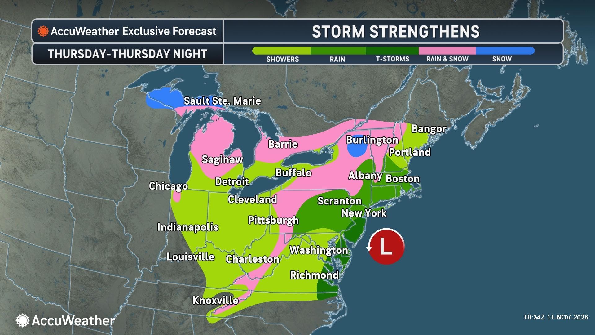
The storm is expected to develop over the central United States before moving eastward and strengthening near the Atlantic Coast.
Find out what's happening in Across Virginiafor free with the latest updates from Patch.
Although it could eventually behave like a nor'easter, AccuWeather reported Wednesday that the system will spend much of its journey inland, limiting its potential to produce the sustained coastal winds and flooding associated with more damaging nor'easters.
AccuWeather says the storm may briefly develop more recognizable nor'easter characteristics late Friday night into Saturday as it approaches and moves beyond the Northeast coast.
Forecasters expect rain across major Northeast cities and wet snow at higher elevations from the southern Appalachians into New England. Prolonged coastal flooding and beach erosion are not expected to be major concerns with this system.
For Virginia, the most noticeable effects will likely be Thursday's rain, snow in the mountains and a sharp temperature drop.
Virginia Snow Forecast: What's Changed?
Virginia's higher elevations still have the best chance of seeing the season's first accumulating snow.
The NWS expects approximately 1 to 2 inches in the Allegheny Mountains, although snowfall estimates have decreased since Monday.
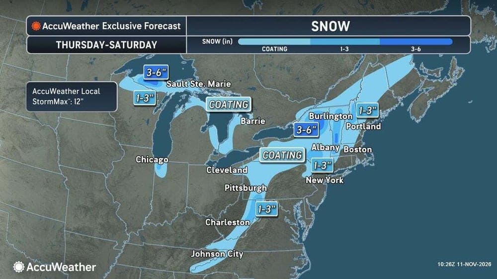
Rain could change to snow in the mountains late Thursday night as colder air arrives. The NWS identifies late Thursday night through Friday evening as the main period for accumulation, with snow showers gradually tapering Saturday.
According to the agency's Wednesday hazardous weather briefing, temperatures may initially be too warm for much accumulation except along the highest mountain ridges.
By Friday night, temperatures could fall into the upper 20s to around 30 degrees, allowing snow to accumulate on roads and other surfaces. Travel disruptions are possible, particularly in the higher elevations where winds could gust up to 40 mph.
AccuWeather similarly expects many higher-elevation locations across the Appalachians to receive a slushy coating to a couple of inches, with larger totals possible along the highest ridges.
For communities along Interstate 95, including Alexandria, Arlington, Fairfax, Woodbridge and Fredericksburg, snow remains unlikely.
The NWS does not anticipate a significant winter storm along the I-95 corridor, across the Piedmont or in the Shenandoah Valley.
Coldest Air Of The Season Arrives
While much of Northern Virginia may miss the snow, residents will still feel the approaching cold front.
Temperatures will fall sharply Thursday night as northwest winds strengthen behind the departing system.
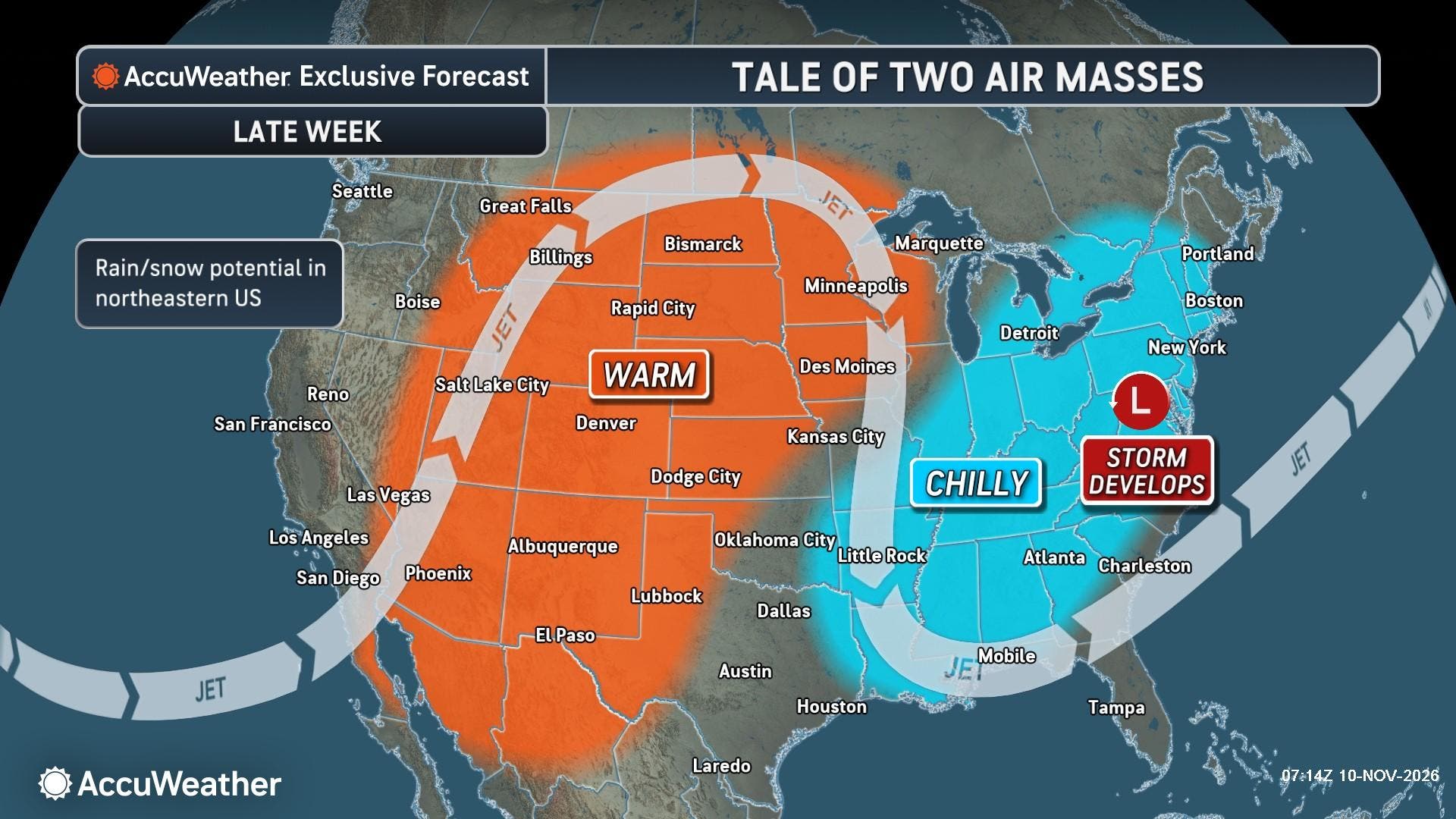
Highs Friday and Saturday are expected to hover around 50 degrees in the Washington suburbs, about 15 to 20 degrees cooler than earlier in the week.
Winds could gust around 30 mph near Dulles International Airport, making outdoor conditions feel even colder.
AccuWeather says the storm will usher in some of the coldest weather of the season across the eastern United States, with temperatures generally running 5 to 10 degrees below historical averages.
The cold could also bring the season's first freeze to portions of Northern Virginia.
The NWS says many locations outside urban centers and tidal shorelines could experience their first freeze by early next week, although the exact timing remains uncertain.
Sunday and Monday nights could be particularly cold as winds diminish, allowing temperatures to fall farther overnight. Residents with sensitive outdoor plants may want to take precautions.
Detailed Northern Virginia Forecast
Wednesday: Sunny, with a high near 68. Calm winds becoming southerly at 5 to 7 mph in the afternoon.
Wednesday Night: Mostly cloudy during the evening, then mostly clear overnight, with a slight chance of rain after 4 a.m. Low around 46. Chance of precipitation is 20%.
Thursday: A chance of rain in the morning, followed by a chance of showers in the afternoon. Cloudy skies gradually becoming mostly sunny, with a high near 64. Northwest winds of 13 to 18 mph, gusting up to 24 mph. Chance of precipitation is 50%.
Thursday Night: Partly cloudy, with a slight chance of showers. Low around 39. Northwest winds of 15 to 18 mph, with gusts up to 24 mph. Chance of precipitation is 20%.
Friday: Mostly sunny, breezy and much cooler, with a high near 51. Northwest winds of 16 to 18 mph, gusting up to 30 mph.
Friday Night: Partly cloudy, with a low around 34.
Saturday: Mostly sunny, with a high near 50.
Saturday Night: Partly cloudy, with a low around 35.
Sunday: Mostly sunny, with a high near 52.
Sunday Night: Partly cloudy, with a low around 33.
Monday: Mostly sunny, with a high near 53.
Monday Night: Partly cloudy, with a low around 32.
Tuesday: Mostly sunny, with a high near 53.
Get more local news delivered straight to your inbox. Sign up for free Patch newsletters and alerts.