Community Corner
A Look at Northern Virginia Traffic
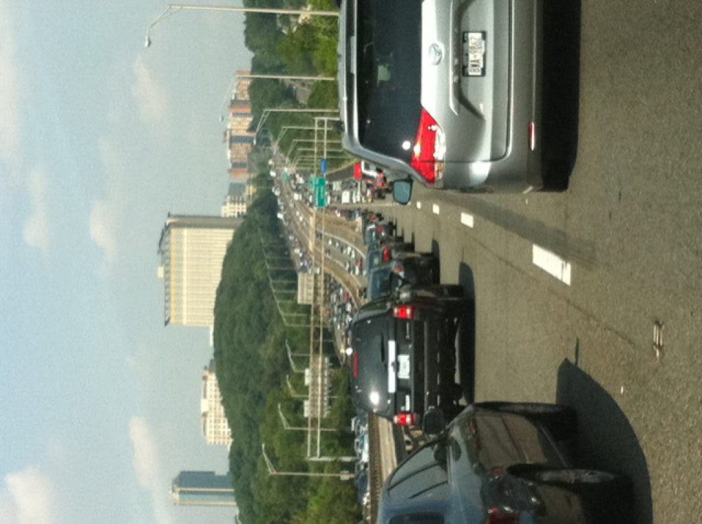
In Northern Virginia traffic is a constant source of irritation, conversation, and local news coverage, and a daily variable we all need to factor into our professional, family, and social commutes.

Issue
Some days a predominant aspect of our waking hours can sound like a covert coded message: I-95 to 395 to 495 to 270 and back, over. Anyone who has tried to get on our local highways from any of our major surface street arteries (such as Franconia or Telegraph Roads, Van Dorn Street, or Route 1), knows one fender bender or even a preannounced stretch of construction can modify all of our plans and mess up our entire day.
We also know the status quo is partially due to the fact that competing political interests within and outside our state have played out to thwart our region’s priorities. Meanwhile reality stares all of us in the face: we either improve our transportation equations or our ever increasing population growth and the relative concentration of major employers in specific locales such as D.C. proper, the Pentagon, Tyson’s Corner, the City of Alexandria, Fort Belvoir or the upcoming BRAC-plus-NGA-Springfield fiasco, will turn our headaches into nightmares.
Find out what's happening in Greater Alexandriafor free with the latest updates from Patch.
History
In 2002, the Virginia General Assembly created the Northern Virginia Transportation Authority (NVTA) and charged it with developing a long-range regional transportation plan. That plan, a blueprint for establishing transportation investment priorities, has quickly evolved from the original TransAction 2020 Plan, to the 2030 version, to today’s 2040 updated version, in less than a decade. Updates come out about every other year.
Find out what's happening in Greater Alexandriafor free with the latest updates from Patch.
As a starting point, the 2030 vintage plan (early 2006) stated that the Northern Virginia region contained 8% of the state’s roadways but accounted for 21 percent of the vehicle miles traveled, and that was on top of accounting for 75 percent of the state’s transit ridership.
Added to this serious imbalance, the plan pointed out that: “Within the next 25 years, [our area] is expected to absorb 651,400 new jobs and attract 918,500 new residents,” for a regional population of over three million people. This growth “may contribute to a housing shortage forcing residents to [move] outside the region, and requiring longer commutes [thus] compounding congestion.” The plan then estimated that $15 billion was needed to alleviate the congestion and enhance our transportation system.
Five years later, the 2040 vintage plan (late 2010) states that over $16.6 billion is now needed to complete the plan’s projects and that meanwhile our “highways have deteriorated significantly.” Furthermore, it points out that despite “planned transportation investments of about $30 billion from 2005 to 2030, Northern Virginia’s highways will continue to decline.”
It specifically points out that even if that proposed investment becomes reality “portions of I-95, I-395, U.S. Route 1, U.S. Route 7 and the Dulles Toll Road will continue to see one hour or more of stop-and-go traffic in the a.m. peak period.”
Over a series of articles I will trace several aspects of our area’s traffic dilemma, delving into such issues as our national highway system, the technology behind traffic lights and the new technology frontiers in transit management, and how we can best anticipate or react to our own local traffic patterns to ease our travels.