Weather
Hurricane Remnants Could Mean Stormy Weekend In MD: See Impact, Timing
Hurricane Isaias is now a Category 3 cyclone and is expected to make landfall late Friday. Here's how the storm will impact Virginia.


Hurricane Isaias' anticipated Florida landfall is teeing up for a cloudy, wet weekend that will see heavy showers and thunderstorms in Virginia.
Dry conditions will persist Friday and Saturday, with peak temperatures reaching the mid-70s on both days. By Sunday, however, things take a dark turn.
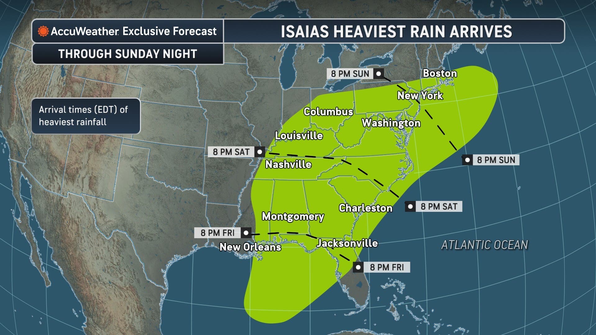
National Weather Service forecasts indicate the first round of showers will arrive in the D.C. region after 4 a.m. Sunday, potentially totaling a tenth and a quarter of an inch.
Find out what's happening in Across Virginiafor free with the latest updates from Patch.
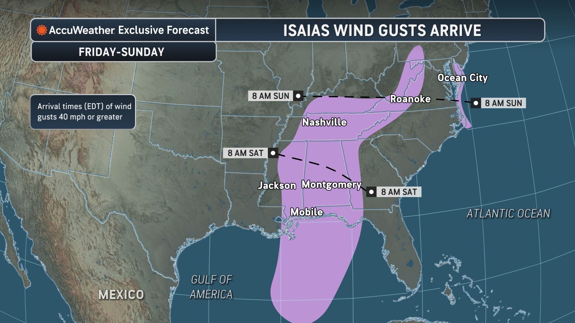
Sunday will see intermittent showers, with thunderstorms possibly moving into the region after 5 p.m. Northern Virginia can also expect wind gusts to near 30 mph.
The storms are forecast to stick around through Sunday night, and potentially through Monday morning. NWS says there's a 60% chance the showers will impact commuters before 8 a.m. Monday.
Find out what's happening in Across Virginiafor free with the latest updates from Patch.
Keeping Tabs On Isaias
Hurricane Isaias is expected to make landfall near Florida's Pensacola Beach area between 8 p.m. Friday and 1 a.m. Saturday.
Although the storm was upgraded to a Category 3, AccuWeather reports the cyclone could make landfall as a Category 2 hurricane.
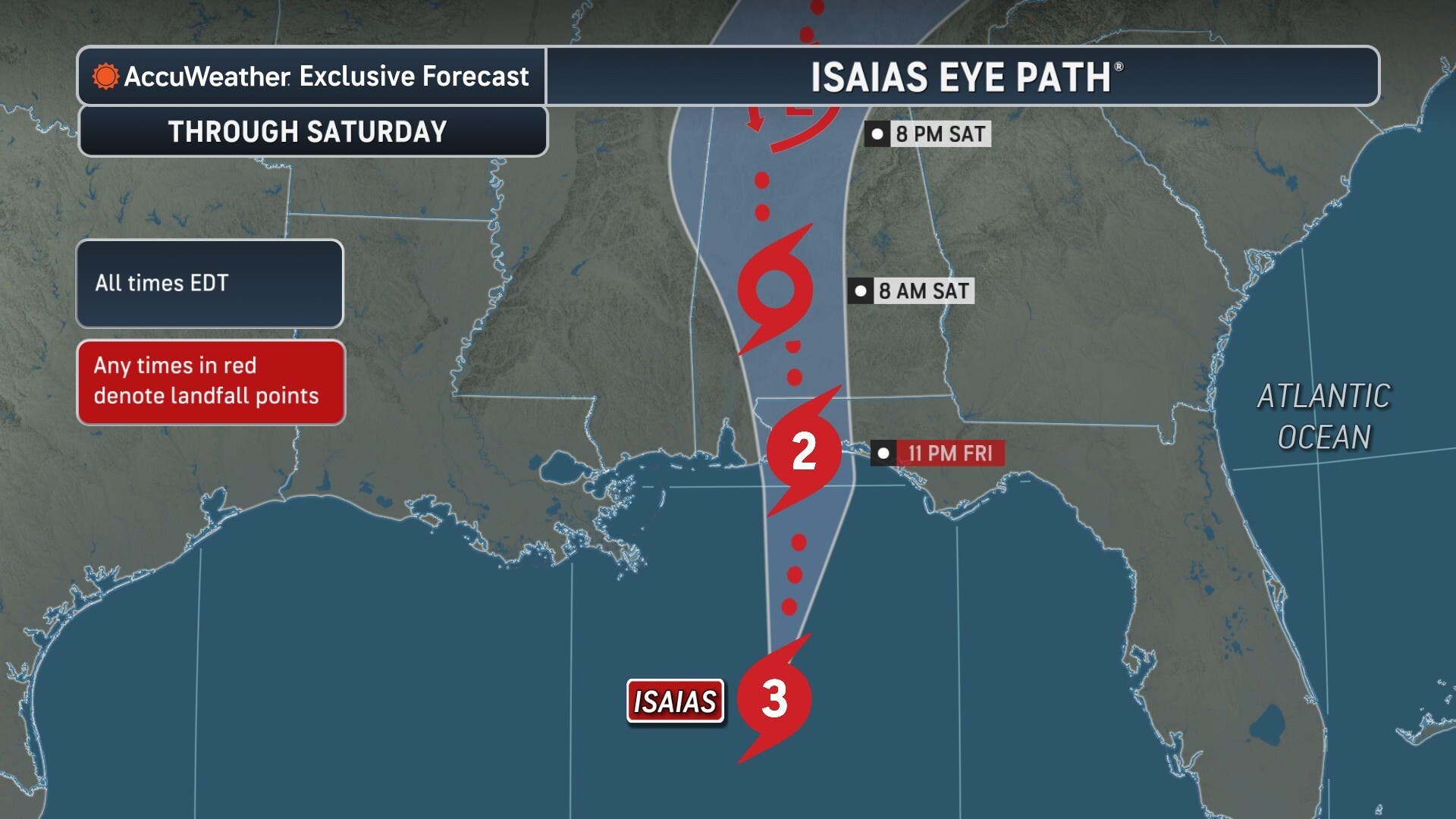
"Isaias is in a race against the clock,” AccuWeather expert meteorologist Tyler Roys said in a statement. "Strong winds high in the atmosphere are expected to disrupt the hurricane before landfall, but if those winds arrive even a few hours later than expected, Isais could maintain its Category 3 strength."
"Regardless of whether it makes landfall as a Category 2 hurricane or Category 3 hurricane, communities along the Gulf Coast face a serious threat from life-threatening storm surge, damaging winds and flooding."
The latest advisory from the National Hurricane Center says Isaias is moving north-northeast at 16 mph.
"Weakening is expected beginning tonight after Isaias makes landfall, and the storm is likely to become post-tropical by late Saturday," the alert reads.
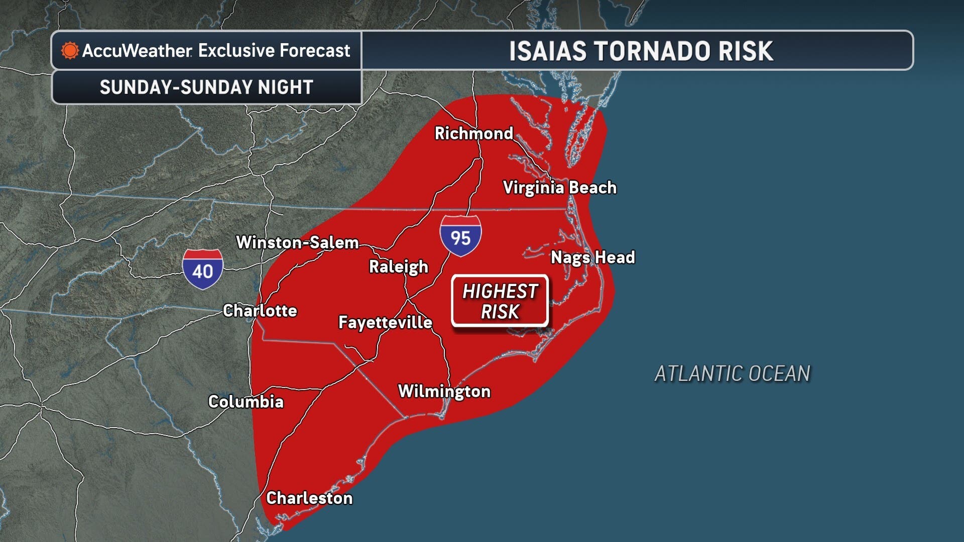
Anywhere between 2 and 5 inches of rain, with isolated totals up to 10 inches, could fall across the U.S. Southeast. The NWS also says tornado risk is possible through the weekend.
Detailed Forecast For Northern Virginia
Friday: Mostly cloudy, with a high near 74. Northwest wind around 8 mph.
Friday Night: Mostly cloudy, with a low around 52. Calm wind.
Saturday: Mostly cloudy, with a high near 72. Calm wind becoming east 5 to 8 mph in the afternoon.
Saturday Night: Rain likely, mainly after 4am. Cloudy, with a low around 59. East wind 6 to 8 mph. Chance of precipitation is 60%. New precipitation amounts between a tenth and quarter of an inch possible.
Sunday: Rain before 2pm, then showers between 2pm and 5pm, then showers and possibly a thunderstorm after 5pm. High near 68. East wind around 14 mph, with gusts as high as 28 mph. Chance of precipitation is 100%.
Sunday Night: Showers and possibly a thunderstorm before 11pm, then showers likely. Low around 63. Chance of precipitation is 80%.
Monday (Columbus Day): A chance of showers before 8am. Partly sunny, with a high near 74. Chance of precipitation is 30%.
Monday Night: Partly cloudy, with a low around 58.
Tuesday: Mostly sunny, with a high near 78.
Get more local news delivered straight to your inbox. Sign up for free Patch newsletters and alerts.